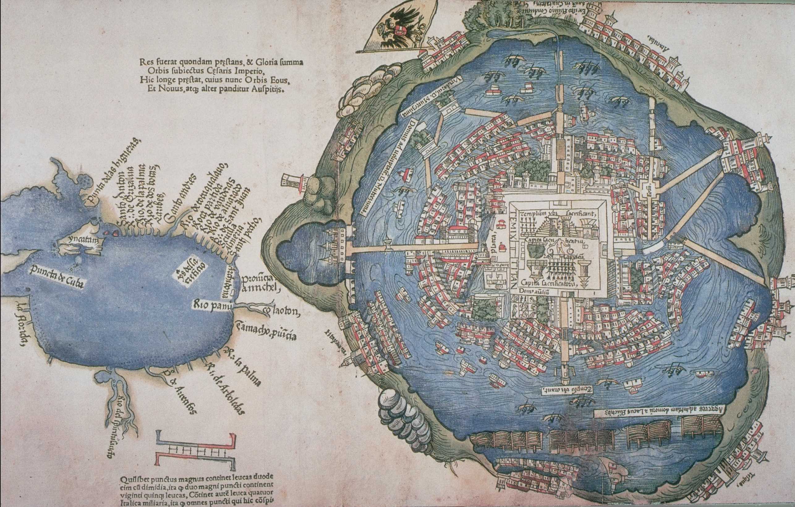
From Tenochtitlan to Mexico City: Cartography as a tool of colonialism
Focus Work, Arthur Piaget, 2024

Founded in 1325 on an island in lake Texcoco, Tenochtitlan was the political center of the Mexica empire. In this specific environment, a closed basin fed by more than ninety rivers, streams and springs, the Mexicas constructed one of the most inhabited and organized state of the precolonial era, thanks to their ability to interact with the landscape.
The city was articulated around an important network of canals and its urban fabric was “genuinely lacustrine. [It] allowed the management of the lakes for gathering and producing food, for transporting people and goods, and for defense.” Those aspects explain why the Mexican writer Gonzalo Celorio describes the Mexica capital as “a […] city, comparable only to Venice, the fantastic city par excellence, that amphibious city, [...] that city of floating terrains, where the elements coexisted in harmony.”
Such a complex territorial organization had been eroded since the conquest of the city by the Spaniards in 1521. The imposition of the European culture in the Mexica realm embraced a territorial scale, to such an extent that the term ‘basin’ has been replaced by the word ‘valley’ when describing Mexico City and its surroundings.
The main focus of this essay is the role played by cartography in the balance of power between the colonists and the Mexicas and in its consecutive territorial transformation. Indeed, we can stipulate that at the time of the Conquest and in the decades that followed, maps were documents charged with a specific meaning in order to accelerate the cultural and physical Europeanization of the Basin of Mexico and its urban hub. Indeed, we can affirm that they sowed the seeds of a coloniality that has eroded this environment, in such a way that today, “[Mexico City] is more a product of its history than of its geography.”